Select Page

Backroad History: U.S. Route 101

Welcome back –  to the backroads. Good to see you again. In our last installment of Backroad History we took a ride down PCH otherwise known as California 1. I hope you enjoyed the trip. I know you might be wondering why we stopped our trip so short, there’s plenty more rode ahead. Though you might be right, that’s not PCH up ahead but US 101. As you might have read in the last article, PCH, indeed, stops in Legget, CA. This may seem confusing and conflicting concerning the many different viewpoints on the internet. Many calling the entirety of US 101 PCH, but that is just not the case. The two are, in fact, separate. Though they run concurrently at certain points the closer you get to San Fran, they are still considered different highways and have their own respected names, wearing it on their sleeve like a motorcycle patch. 

Since we like to keep things somewhat coherent here at Backroad History we just simply couldn’t continue the article and ride all the way up to Washington, as much as many of you wanted us to do, we’re sure. That’s why we’d like to continue our trip with you all, down these long connected roads,  in this short-er – mini-esc – Backroad History segment. Why is this article slightly shorter than others you ask? Well because, simply put, there are just so many more highways to explore in the world that we’d like to get to. One in particular in Alaska we’ve been dying to ride. That and considering where we are, it’s a straight shot from here in Legget all the way up to 101’s end at Tumwater, WA. So, let’s not waste any time and get right to it. Let’s finish our trip here on the West Coast and take a ride down from Legget, CA up to Tumwater, WA. Let’s explore the Backroads of US Route 101 in this – sort-of-mini – segment of Backroad History.

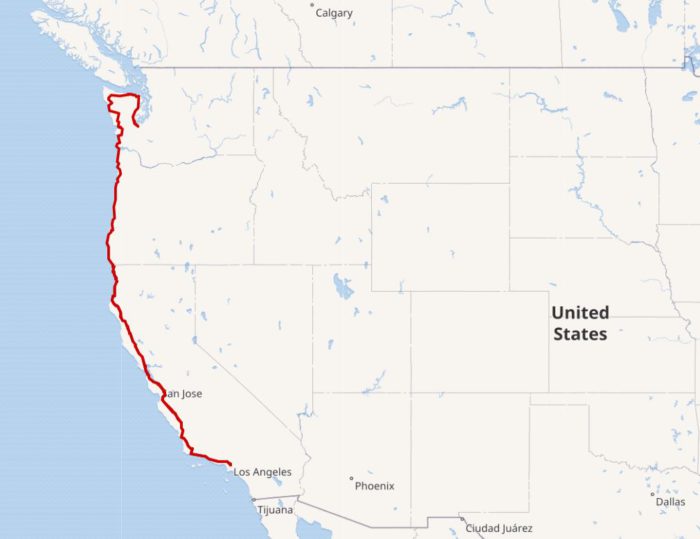
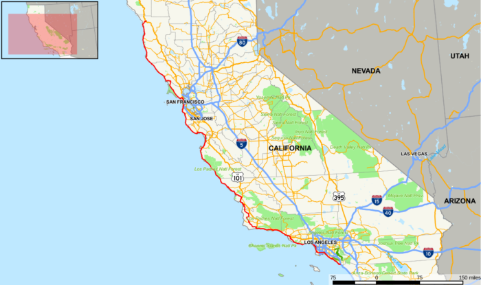
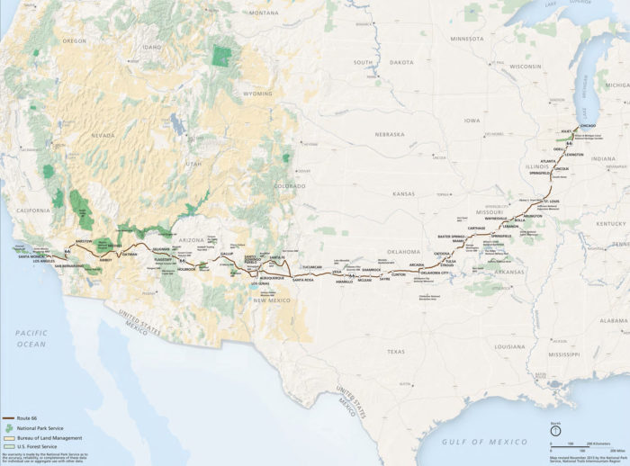
(Map of US 101, from start to end; from Los Angeles to Tumwater)


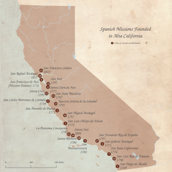
Before we continue our trip up to Northern California however, let’s first, briefly, explore the history of US Route 101 where it all began, all the way down by the Mexican Border. That’s right, it once ran all the way to Mexico. In fact the 101 was taken from a much grander, older, highway than itself. One of the oldest and longest in the Americas, the oldest in California,  El Camino Real. The name is Spanish for The Royal Road, otherwise known as The King’s Highway. El Camino Real was one of the many highways commissioned by the King of Spain back in its colonial days, all the way back in the late 1700’s to be more exact. This route, indeed, followed some of the same routes of famous Spanish explorers. Its original intention was to connect the 21 missions of California, all created by the Spanish of course. Although it ended up doing much more than just that, as it served as California’s main highway from the beginning of its Statehood in 1848 all the way up until the construction of US 101 in 1926.


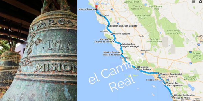
US 101 faithfully followed along the original route of El Camino Real, from San Diego, California to Sonoma. From Sonoma, however, construction continued and it was expanded all the way up through Northern California, Oregon, and into Washington State where it stopped in Tumwater (see original map). Along the way it replaced much older highways than itself, and was later even renamed in other states, such as Oregon, becoming Oregon State Highway in 1931. It was renamed in parts of California as well in 1964. If you recall we already rode parts of US 101 during our trip up PCH (Pacific Coast Highway). That’s right, the stretches of the 101 that were renamed in California became PCH, otherwise known as California 1. 

I know it seems confusing, but don’t worry about it as the stretch we’ll be riding up is and has been known as US 101 since 1926 and since that year, following its construction, it has served as the main coastal transportation route all along the West Coast of the United States for several decades. Surprisingly, it  remained virtually unchanged all through the 30’s and 40’s and it wasn’t until the late 1950’s that it began to not only be re-routed but to be expanded as well. Around this time the federal government began a massive federal highway expansion plan, as mentioned in our first article, that led to the creation of the US Interstate System, which unfortunately led to, useful, famous routes like US Route 66 being disbanded. That same fate would befall US 101 as major sections of it began to be replaced by Interstate 5, especially in Southern California where a vast majority of it was disbanded. 

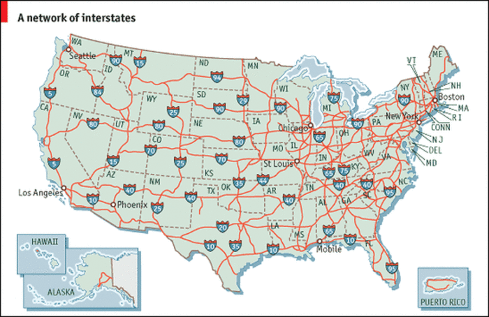
(As seen in Article 1; the expansive interstate highway system put in place by the Federal-Aid Highway Act of 1956)


Virtually everything south of Los Angeles was destroyed, re-named, or merged with another highway. Only a few unchanged sections and pieces of the original remain today, throughout Los Angeles, Orange County (a county just below Los Angeles county above San Diego County) and San Diego / San Diego County (a county above San Diego). Fortunately for us we are starting our trip from Legget, so we don’t have to worry about weaving through the complicated remaining sections left in Southern California. We get to enjoy a smooth ride, a less complicated one, all the way up to Tumwater.

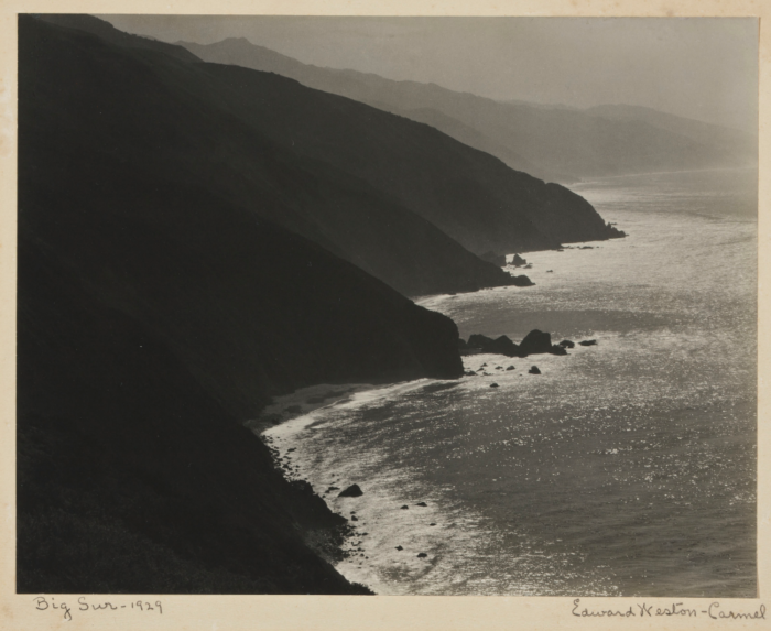
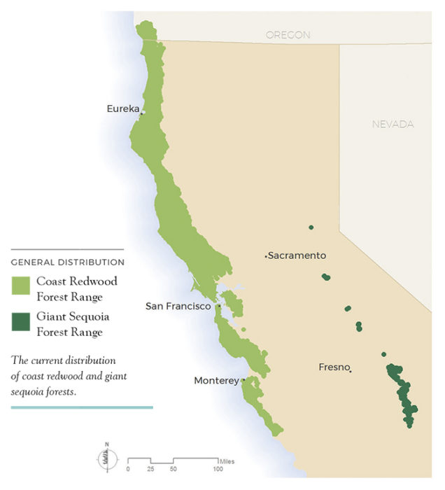
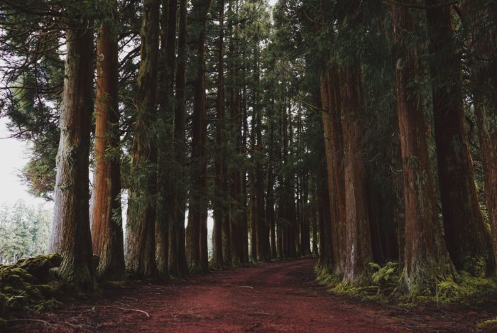
Now that you know a bit about its backstory, we can confidently finish our ride, knowing what is behind us and what is up ahead – on to Tumwater. There are many scenic routes along 101, and starting from San Francisco they all begin with the California Redwood sites.  Let’s start by heading down  some of the many backroads of Northern California, where the infamous Red Wood trees adorn the sides of the highways, in fact, much of the 101 in Northern California has been nicknamed the Redwood Highway and for good reason. Riding along this route you’ll get to see some of the tallest and oldest trees on Earth, all the way from San Francisco up to Oregon.


Before you make that drive, if you have time, we suggest first making a detour to Yosemite National Park just 3 hours east of San Francisco. It’s basically a straight shot via CA-120 West and I-580 West. In our humble opinion, Yosemite is the best National Park in the United States. So, you won’t want to miss a once in a lifetime experience. A  6 hour round trip is more than worth the drive. We’ll leave this link for you here, in case you want to take a look…https://www.yosemite.com/

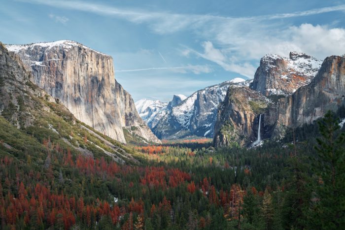
(Yosemite Valley; Yosemite National Park)


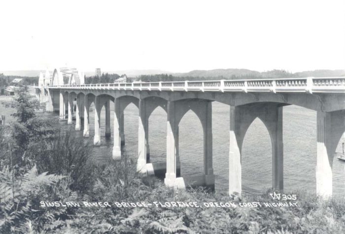
Once you’ve made your way up to Oregon, hopefully after having decided to take a few days to go to Yosemite before venturing up through Nor Cal, you’ll enter just south of Brookings. Keep following the highway up to make your way to Washington. But, try not to be in a hurry, as Oregon has plenty to offer in scenery along the 101. You’ll cross some of the most famous bridges in America, several of which are listed in the National Register of Historic Places. The entirety of US 101 in Oregon, otherwise known as Oregon Coast Highway, is registered as a State Byway. So, you can be sure to see some great things along the way.


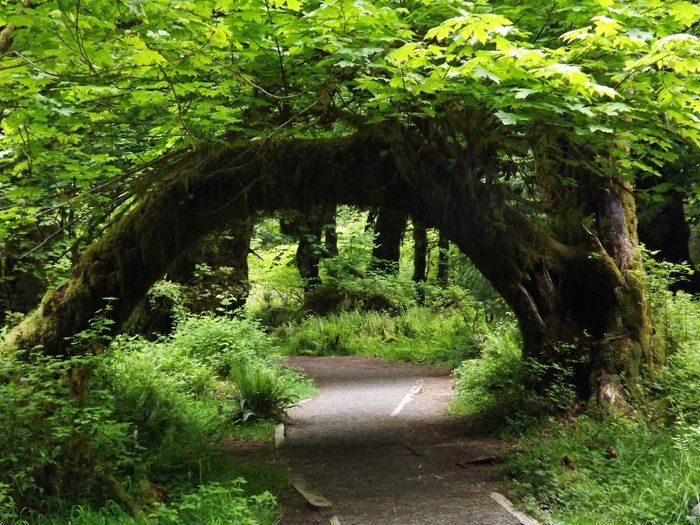
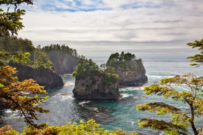
Upon finishing your trip through Oregon you’ll enter Washington on the north end of Astoria-Megler Bridge, just west of Megler. From here, you will no doubt be closer to your final destination Tumwater, just shy of being 2 hours out in fact. The 101 in Washington, although short, is a site to behold. There are many great beaches to explore, with large monolithic esc rock formations jutting out from the coast, unique to only the Washington coast. Such rock formations can’t be seen anywhere else in the world. Once you leave the coast and get closer to Tumwater you’ll explore many great forests as well, with unique shaped trees that make you feel as if you are traveling through a Fantasy land. 

While traveling along the US 101 in Washington you’ll come across the Olympic Peninsula loop, a nicknamed portion of US 101 in Washington that follows the outer edges of Olympic National Park, one of the best National Parks in America, ranked not far behind Yosemite in our opinion.

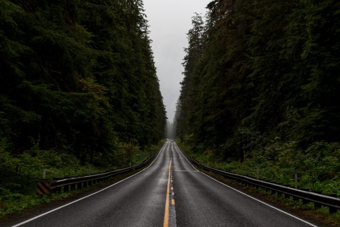
Enjoy the trip, take it slow, go off road, and explore a bit of the wilderness if you can. Just like Yosemite, you’re going to want to explore the many forests of Olympic National Park.


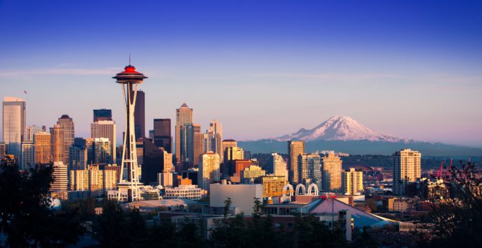
Once you make it through the Peninsula loop you’ll arrived at your destination, yes you guessed it, Tumwater. But don’t stop there, while there’s not much to see in Tumwater there is a bit more to see in Olympia, the capital of Washington, only a 5 minute drive away. We suggest you relax here and take in the long road trip that was and enjoy many of the wonderful local shops and cafes in Olympia. If you’re up to it, you could travel an extra hour up to Seattle and relax there…whatever suits your fancy. Just relax, before you start to plan your next big road-trip, or, better yet, you could let us do that for you, in the next addition of Backroad History… We hope you enjoyed the read.


Before you go, check out this article for some extra scenic spots, not listed above, to further enhance your trip, up the Backroads of US 101…https://www.roadtripusa.com/pacific-coast/. Don’t let the title of the site fool you though, it’s not Pacific Coast Highway, but US 101, except for the few portions in California we discussed in Article 2, of course. It’s a great information source, nonetheless, with great itineraries. So, please feel free to explore what it has to offer. And if the title really does confuse you, please feel free to re-read Article 2 and this Article of Backroad History.  No really, we’d appreciate it. All right that’s all we have for you for now… we were trying to keep this article sort-of-mini-like…Well, regardless, we hope you enjoyed it.

Until next time…


Best, 


The CrossHelmet Team.

Backroad History: California 1

Welcome back – to the backroads. Good to see you again. In our last installment of Backroad History we took a ride down perhaps one of the most infamous motorcycle routes in the U.S., U.S. Route 66. Infamous indeed, but does being the most infamous make it the best? Not quite. While U.S. Route 66 is arguably one of the best motorcycle routes anywhere, I would argue there are many other routes in the world that rival its grandeur. But before we go exploring elsewhere, let’s stay in the states for a while, being that we just finished our trip down the backroads of Route 66. As there are quite a few other routes here that may be just as good as Route 66, or perhaps even better in fact. That’s for you to decide. 

Likewise, since we just took a trip from Chicago to Los Angeles, let’s stay in Route 66’s final destination for a bit, Los Angeles, CA. After you’re done relaxing we’ll start another trip from here. But while you’re in LA, check out these LA travel guides:


https://www.adayinlatours.com/?gclid=CjwKCAiAjs2bBhACEiwALTBWZfG7ANdUs52qo2Ygc0z_iaRjDXk6iw3FkQ2sit5kFhggSMQGkc_u_hoCBBMQAvD_BwE


https://www.discoverlosangeles.com/


https://www.nomadicmatt.com/travel-guides/united-states-travel-guide/los-angeles/


LA is a great city with many great things to see and do, but do be wary of the traffic, especially if you are on a motorcycle. As someone who has lived in the city I’d suggest not riding your motorcycle while you’re here and wait until you’re ready to leave to do so. It’s best to leave in the early hours of the morning, sunrise to be more exact, to beat the traffic. Now that that’s out of the way and you’ve enjoyed basking in the LA sun for a while, let’s start our next trip. This time from LA up to San Francisco. 

Let’s take a ride and explore the backroads of arguably the best motorcycle route in the U.S. – Pacific Coast Highway, otherwise known as California 1. What makes this particular route the best you might be thinking? How did it get started? Well, let the CrossHelmet Team fill you in on said thoughts and many others you might have in this segment of Backroad History. So buckle up, or if your riding a motorcycle then put on your helmet and allow us to guide you, as you ride on a Journey, down the Backroad, down California 1.

Pacific Coast Highway or California 1 runs from it’s most southern point in Dana Point, which then meets Interstate 5, to Leggett in Mendocino County, California, it’s most northern point, where it then meets U.S. Route 101. It sometimes runs concurrently with the U.S. Route 101 and parallels Interstate 1, especially between Ventura and Santa Barbra and across the Golden Gate Bridge, but nonetheless it still considered a part of California 1. What makes this route so famous is that not only was it once the longest route in the world and still amongst the longest in the world today, especially in the U.S., but it also has some of the most spectacular views out of any highway anywhere. More spectacular than Route 66 perhaps. It is widely known for its scenic beauty, as it stretches across the marvelous California Coastline.

The highway began its infancy all the way back in 1919, when Dr. John L.D. Roberts, founder of the town of Seaside, California, (a small city 115 miles south of San Francisco), saw a need for a road along the Big Sur Coast after traveling up and down its rigid rocky paths, on horseback, to treat patients. 

He subsequently began to take pictures of the area and shortly after gathered a team and began construction on the soon to be mega coastal highway. Later Dr. Roberts received massive assistance in building the highway,when in 1921 voters approved federal funding for his project.

The federal government commissioned San Quentin Prison to build the road, which set up three camps down the coastline to aid with the construction. Many locals too worked on the road. One of those locals being John Steinbeck. Yes, the same John Steinback that wrote ‘The Grapes of Wrath,’ and unlike the road he coined as the ‘Mother Road,’ Pacific Coast Highway did not serve as a mass exodus route during the Great Depression, for obvious reasons. Not just because it was located in California, the grand destination of the many ‘Okies,’ but because unlike Route 66 it was not all built as one big project. Pacific Coast Highway started as a series of other roads that were later connected throughout decades of time. Many of the roads each having their own individual unique names and numbers. 

For example, one of the first segments of Pacific Coast Highway was actually built around 1911. That being Rincon Sea Level Road in 1911 from Ventura to Santa Barabra in Southern California. Many segments like this would later be added to Pacific Coast Highway. As it wasn’t until the completion of the Big Sur portion of the highway that there even was a Pacific Coast Highway. It was Big Sur that officially started it all. 

The construction and planning of the Big Sur portion took nearly 20 years, as it was the hardest portion out of any built, due to the excessive high cliffs and rocky coastline. What ultimately helped and led to its completion in the end, was ironically President Roosevelts ‘New Deal,’ during the Great Depression, which was a series of programs, financial reforms, and public projects like that of the construction of California 1.

This rough, first, section of California 1 finally opened in 1937 and if you were to travel down its routes all the way back in its inception period you would find a series of interconnected roads that appeared unmarked and unnamed, as the official designations of the many roads, at first, were not marked or used on maps and were only used by California State officials, especially state highway planners.  Names and numbers set aside, the route would still have been amazing to travel down at this time, though you may get lost at times. You would very likely see the same gorgeous scenery that can still be seen today. As much of the route remains very rural and the landscapes untouched.

If you were to travel later in the 40s you may see many military installations pop up near the highway, as America entered WWII. Specifically, the U.S. Army’s Fort Ord which began to ramp up its troop numbers and training exercises during this time. The Fort was later handed over to the city of Marina, where it is now home to California State University Monterey Bay. Like Route 66 if you were to travel in the 50’s and 60’s you would begin to see a changing and more prosperous America in many of the coastal cities, close by or along the route. Unlike 66 you would not see a decline in the years to come, as Pacific Coast Highway has remained a highly useful and beautiful route that is often used by many Americans, especially Californians, to this day.

The ultimate goal of the highway, as Dr. John L.D. Roberts intended, was to connect many of the California Coastal towns isolated along the coast, which it most certainly accomplished. But it did much more than that, in fact, as it also provided travelers access to beaches, parks, and other attractions. It became more than just a necessity. It became a travel destination, attracting people from all over America and eventually the entire world. As with many roads, construction and maintenance with California 1 was ongoing following its completion. Perhaps more so than others, as at times parts of the route became inaccessible due to landslides or other natural phenomena. This however did not deter travelers, nor should it deter you, as this was not a common occurrence, but has happened several times throughout its history.  These minor irritations were always fixed by the California Highway service, thus keeping drivers on the road and continuing to attract them from all over. 

What we know today as California 1 was officially designated in 1964, where all the routes were combined under that one iconic name. 

From that point onward it gained immense popularity, and the route has become a popular bypass away from Interstate 5 for travelers to view the spectacular scenery. Down its routes you’ll find some of the world’s largest trees and some of the best beaches in the world. What better way to take it all in than on your motorcycle. 

The weather is almost perfect all year around, so no need to worry about the elements. Yet regardless, I suggest riding in the Spring and early Summer time, as that will be the most pleasant time of year to ride and a perfect time to take a dip in the ocean. 

If you decide to take up a journey down its paths, there’s no need to worry and over prepare, as it should be some of the easiest riding you’ll ever experience. But do watch out for landslides, although very rare it can happen, and be sure to check out the weather report for rain beforehand. It can tend to rain more the closer you get to San Francisco. I suggest planning a trip down this route when it’s nice and sunny, which is usually the case year-round. If you’d like more detail on how to plan a trip down Pacific Coast Highway check out the links below:


https://www.roadtripusa.com/pacific-coast/california/central-california/san-simeon-hearst-castle/

https://highway1roadtrip.com/things-to-do/highway-1-scenic-drives-where-to-stop/?gclid=CjwKCAiAjs2bBhACEiwALTBWZTp3DD4tz9d5KxuHROeHA628anqpX3L8n5D4Q32HSt9LLzQN3GzrSRoC5_QQAvD_BwE

https://www.motourismo.com/en/listings/3035-5-day-highway-1-coastal-adventure-in-california?gclid=CjwKCAiAjs2bBhACEiwALTBWZYw5E6FWLe7-qlHkPz66Mqg7voIcBfcGKaw9GFlWlFtJ1uOjEHFuhRoCSPQQAvD_BwE

Thank you for the read, as always! I hope you enjoyed it and found some helpful information along the way. Be sure to come back for more Backroad History, in the near future. If you did enjoy this article let us know, so that we can make many more like it in the future. There’s so much more to come on Backroad History! 

Thanks again!


Sincerely,


The CrossHelmet Team.


Backroad History: U.S. Route 66

I’m sure many of you have heard of the infamous Route 66 and those that have probably wondered how it came to be, maybe even wondered what it was like riding down it and how you could take up a trip down its roads someday. Well, let the CrossHelmet Team fill you in on said thoughts and many others you might have in our Backroad History segment. So buckle up, or if your riding a motorcycle then put on your helmet and allow us to guide you, as you ride on a Journey, down the Backroad, down Route 66.

Undoubtedly, one of the most famous routes in the world for riding, U.S. Route 66 was officially commissioned in 1926, according to the National Museum of American History, with it, believe it or not, being fully paved by the late 1930’s. This was an historic time throughout America for new highway systems, as new highways began popping up all over the country. While US Route 66 was not the first highway specially designed for automobiles in America nor the first long distance highway of such, it was, according to many, the best route from the east to the west. The best ride from Chicago to Los Angeles. 

It originally ran through 8 states, Illinois, Missouri, Kansas, Oklahoma, Texas, New Mexico, Arizona, and California. Of course, starting in Chicago, running through St. Louis, all the way to Los Angeles. A massive scenic route that connected the underdeveloped cities of the West with the much more urbanized and industrialized cities of the American mid-west and north-east.  At its inception, it served as the heart of trade and commerce between the eastern and western United States. But more than that, it connected many of the small towns across America that otherwise had no highway system and no connection to the developed areas of America. 

Later, following the 1929 stock market crash, it would give hope to many Americans affected by the Great Depression and the Dust Bowl: a time in American history in which the Great Plains (American mid-west) faced severe drought and dust storms.


These two devastating events led to the Route being flooded by migrants from poorer states like Oklahoma, Arkansas, and Missouri. These migrants, later dubbed Okies, packed into old beat up trucks and cars, sometimes filled with 10 or more people, while towing many if not all of their possessions on the back end, down the route in search of a better life in California. 

The great disparity and extreme poverty of these people was captured in perhaps one of the most famous novels in American history, ‘The Grapes of Wrath,’ by John Steinback. This along with the film later made about it put Route 66 on the map. Thus, making it the most famous highway in America and one of the most famous in the world. The Route became known as the ‘Mother Road,’ a name given to it by John Steinback. Riding down this great route, during this time would be to see one of  humanity’s greatest misfortunes. Despite how awful those times were, they still deserved to be remembered. Many of the routes that were traveled along by people in the darkest times of their life still exist today. To better understand their suffering you can ride down many of those same paths they took and possibly imagine how difficult it must have been for them to undertake such a journey. 

In this November 1936 photo from the U.S. Farm Security Administration, a mother, originally from Oklahoma stands with her five children near Fresno, Calif., where she works as a cotton picker. Despite the promise of a better life in California, life wasn’t much easier there as opposed to life on the ‘Mother Road.’


Although Route 66 had a tough past and saw some rough beginnings, it would see brighter days.

After WWII, America was raised out of the Great Depression and saw a huge economic boom, which would bring many changes and developments to the route. The Golden Age of Route 66 would see the route permanently changed, for the better. Before the Post World War II era the route only saw minor changes after its final paving in 1938. Only a few small alignments and mandates were made by the US federal government, since then. Following the war however, the route began to take on tons of new traffic from returning GI’s looking to start a new life and relocate to the West for more space and freedom. 

This started yet another mass migration down the route, but this time a positive and uplifting one. The western states population during this time grew as much as 40 to 75%, in some states. This massive shift in the American population brought about many new businesses, not only in the major western cities, but along the route migrants traveled, chiefly Route 66. Many motels, service stations, and tourist courts began to pop up all along the route.

Almost all of them still stand today and the route has further become famous because of these attractions. If you were to ride down the route during this time you would, no doubt, encounter traffic in some of the popular pit stops, along the route. You could enjoy the many new amenities of the era, with the latest 1950’s technology and styles. An era that has no doubt been solidified in American history and around the world, with American 1950’s memorabilia being sought after all over the globe. 

To get a better understanding of just what it was like to travel down Route 66 during this era.. check out this quick collaged travel video from the 1950’s:

https://www.google.com/url?sa=i&url=https%3A%2F%2Fwww.youtube.com%2Fwatch%3Fv%3DVFE6ba95eN0&psig=AOvVaw1uLjoyKSv_AaGeLUMSA2oR&ust=1664956362944000&source=images&cd=vfe&ved=0CAwQjRxqFwoTCPi-8PyLxvoCFQAAAAAdAAAAABAS

Unfortunately, this would be the peak of Route 66 and it would steadily begin to decline in the year 1956, when the current American President of the time Dwight D. Eisenhower had his Federal Aid Highway Act passed by Congress. This act began to implement the new US Interstate Highway system and with it Route 66 slowly began to be replaced and bypassed by these new governmental highways, for better or worse. Route 66 from that point onward saw no further development, with all the businesses and federal funding it had moving to the new interstate system. 

Over a period of 30 years the traffic going down the road began to shift to new interstates. Interstates like I-40, which would replace the route between Barstow, California and Oklahoma City; I -55 which would replace the route from Chicago to St. Louis, and finally I-44, which would replace the route from St. Louis to Oklahoma City, finally doing away with Route 66’s usefulness. A little over a decade later after the completion of I-44, Route 66 would officially be disbanded and lose its official highway designation in 1985. 

Because of these new interstates the developments of Route 66 were either abandoned or remained as is, with no further repairs or upgrades to the infrastructure, essentially turning many towns along Route 66 into Ghost towns or towns frozen in time. This feature however, would later add to the appeal of traveling down this route, ironically making Route 66 even more famous.

With all this notoriety Route 66 wouldn’t remain in the shadows and stay out of commission for long… In 1987 The Historic Route 66 Association of Arizona was founded and many of the sites along the route began to be restored and preserved. Following this, many states along the Route began to designate Route 66 as an historical landmark and later many declared it to be a historical State Scenic Byway. The Federal Government soon began to notice the actions taking place on the route and the historical significance the route served to America. In 1990 Congress enacted the Route 66 Corridor Preservation Program which gave further funds and assistance to preserve the highway. Most importantly, it became officially designated as a National Historical Landmark, giving it further significance linking it to the National Park Service. It became a symbol of America, that as stated by Congress in the 1990 legislation, U.S. Route 66 ’embodied the American Spirit, their heritage to travel, and their legacy of seeking a better life.’

Since this time, Route 66 has seen a slew of new travelers down its long winding paths to take in its history, the beautiful landscapes, and the many old shabbies and interesting markers that line its path. What is it like traveling it today? Exactly that, a route filled with naturalistic wonders, with old ghost towns and retro pit stops. Down its routes you’ll be a few short detours away from some of the many historical sites in America, various Native American sites, like Taos Pueblo – the oldest Native American site in North America, and many great state and national parks, including the world’s most wondrous and highly rated National Park, The Grand Canyon. What better way to take all this in than on your motorcycle. You’ll get a real feel of the environment and the true experience of traveling down Route 66. 

But do keep in mind, although the route is motorcycle friendly, and known for its many motorcyclists, it is still an extreme undertaking and a trip down this route on a motorcycle should be planned with care. Oftentimes the weather conditions will change drastically from extreme heat to extreme cold. You will also need special maps if you wish to drive down the route in its entirety, as the route has changed quite a bit, since its decline years from 1956 to 1985, up until its restoration and preservation years of the recent past and today. Don’t let this deter you though, as anything worth doing in life is going to be difficult or challenging, as I’m sure you know.

To help you along your journey, if you decide to ride down this route yourself in the future, there are two links linked at the bottom of this paragraph that could be extremely helpful. The first being a link to a writer and fellow rider on her experience riding down the route on a motorcycle. In this article you’ll find helpful information on how to navigate the route and a few good places to see and stops to make along the way. The second article links you to an official Route 66 motorcycle organization, where you can find the maps needed to navigate the route or even sign up for special group riding tours. Check em’ out…

https://roadtrippers.com/magazine/ultimate-route-66-motorcycle-road-trip/

https://www.eaglerider.com/route-66-motorcycle-tours?gclid=CjwKCAjw-L-ZBhB4EiwA76YzOf_K91G67Aot_UVJ9fTeUlIWmhTx-9mmTd_FHpWBRygUzh73D6YxMBoC-iUQAvD_BwE


Thank you for the read. I hope this information has been helpful and you enjoyed reading about Route 66 as much as we did writing about it. If you enjoyed this article let us know! So that we can make many more like it down the road on some of the world’s – other great motorcycle routes.  


Thanks again!


Sincerely, 


The CrossHelmet Team.